White Rabbit Creator Clubhouse (on the Ashland Oregon Plaza), during the day, is a cafe, Noble coffeehouse and collaborative workspace. By night, White Rabbit is a cultural venue. It’s where individual potential meets collective possibility. Integrating technology, arts, and entrepreneurship. It is Ashland’s “pollinator hub” where people move their ambitious projects from someday to today—whether READ MORE
Category: Ashland
StoryTown Ashland – Ashland Oregon has a cool new app
The Storytown App is an interactive events Calendar App for Ashland. Currently, the app is available for iPhone/iOS. I am assured by the developers that an Android version is in the works. The app allows locals and visitors to explore and interact with Ashland’s events, businesses, and experiences in real-time. You can search & find READ MORE
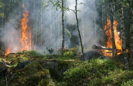
Ashland Oregon Wildfire information, videos and articles
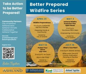
Better Prepared for Wildfires: What’s Your Plan? – July 16, 2025 When a wildfire hits the city of Ashland, Oregon, and surrounding areas, what’s your evacuation plan? An estimated 400 attendees packed the Historic Ashland Armory for a two-hour workshop Wednesday, July 16, 2025, to learn more about what to do to prepare should such READ MORE
The Oregon Wildfire Risk/Hazard Map Saga is Over
July 2025 update – Governor Tina Kotek signs the repeal of Senate Bill 83 The Saga Timeline In 2021, Senate Bill 762 was passed with bipartisan support that will provide more than $220 million to help Oregon modernize and improve wildfire preparedness through three key strategies: creating fire-adapted communities, developing safe and effective response, and READ MORE
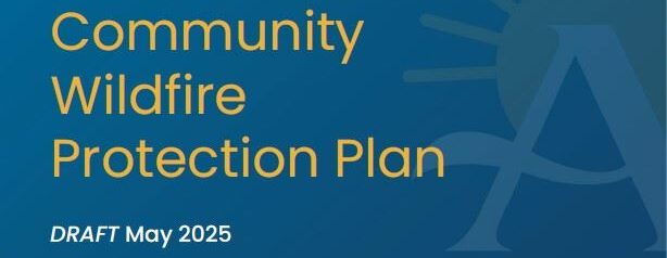
Ashland Oregon’s 2025 Community Wildfire Protection Plan is Approved
The final draft of the City of Ashland Oregon Community Wildfire Protection Plan (CWPP) reflects a citywide commitment to address the escalating threat of wildfire with inclusive planning, science-based strategies, and community-driven solutions. Guided by the Ashland City Council’s 2022 “priorities, vision, and values” statements, this CWPP is a comprehensive wildfire risk reduction blueprint that READ MORE
My list of Wildfire, Weather/Wind, Lightning and Air Quality web sites and apps
The following is a list of the web sites, apps and other sources of information that I use on a daily basis to track the status of weather, wind, air quality, lightning and wildfire information. Wildfire InciWeb InciWeb is an interagency all-risk incident information management system. The system was developed with two primary missions: 1) READ MORE
Ashland Oregon Area Live Cameras
There are several live (on YouTube) cameras that I use as part of my situation analysis for what is happening in and around Ashland Oregon. You can click on each link to open a browser tab that contains the live video feed. Ashland City live cameras Other live cameras in the Ashland area Mount Ashland READ MORE